Trespass Permission: None needed
Directions:
Drive south from Indio on Highway 111 to Highway 195 at Mecca. Turn left on 195 and proceed east about 5 miles across the Coachella Valley canal. Turn left onto Painted Canyon Road and drive 0.3 mile parallel to the leveling line, to the third power pole. The southernmost bench mark (TM08) is 89 m WNW from that power pole. Do not drive off the dirt road, because the area on each side is closed to vehicles since 1994. The level line is on the southeast side of the main drainage of the canyon.
Comments:
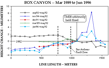
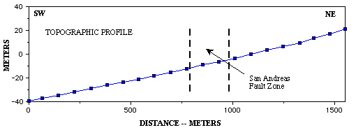
This array was established across the San Andreas fault as a leveled alignment array. The line was lengthened in March 1992 from 624 m to 1550 m by addition of nine more bench marks. It was surveyed by kinematic GPS on 11 July 1997.
Results:
Height changes were insignificant from 1989 to May 1992, relative to bench mark TM08 that may be within the San Andreas fault zone. That part of the line southwest of the fault zone rose about 1.5 mm in August 1992, relative to May 1992, following the 28 June 1992 Landers earthquake sequence, as well as a wet winter in 1991-92. That winter precipitation may have rehydrated the alluvium southwest of the fault zone, causing uplift thereby. The November 1994 and Junue 1996 surveys are nearly identical to each other and to the pre-Landers survey in December 1991, suggesting that any stress changes and resultant strain at this array lasted no more than 2 years, comparable to observations at NORTH SHORE.